
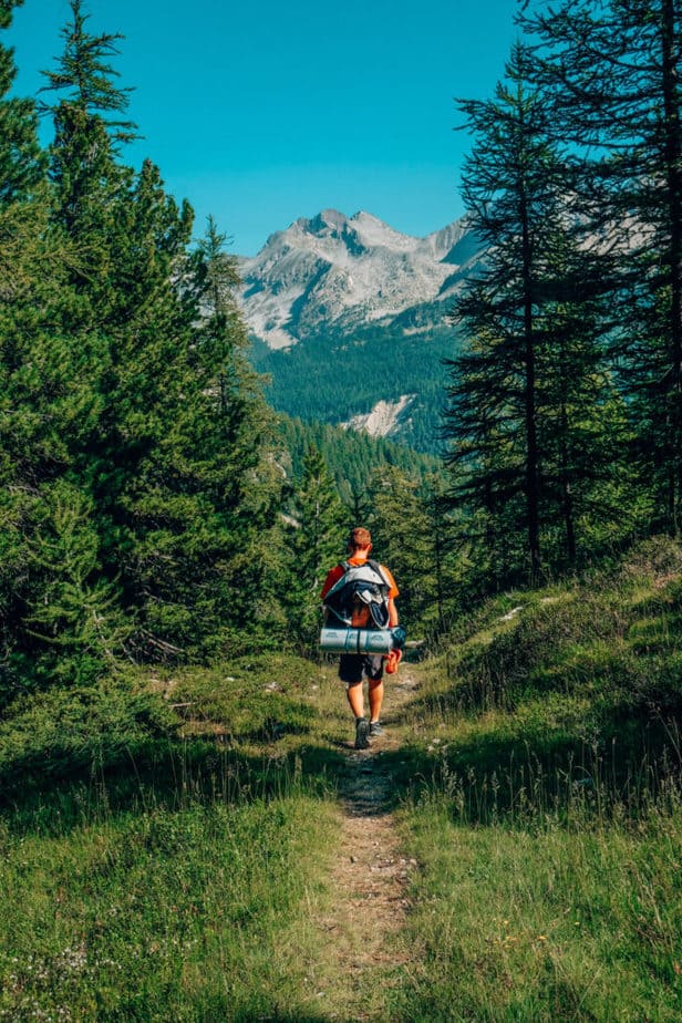
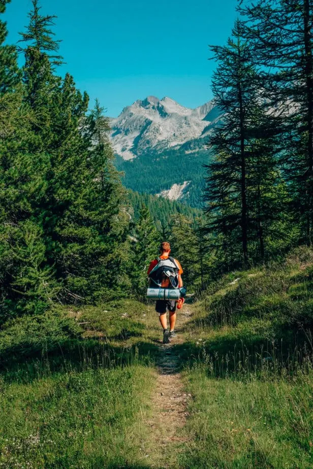
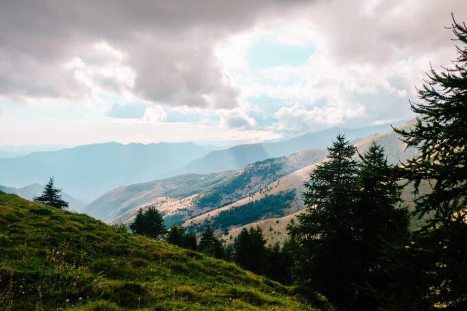
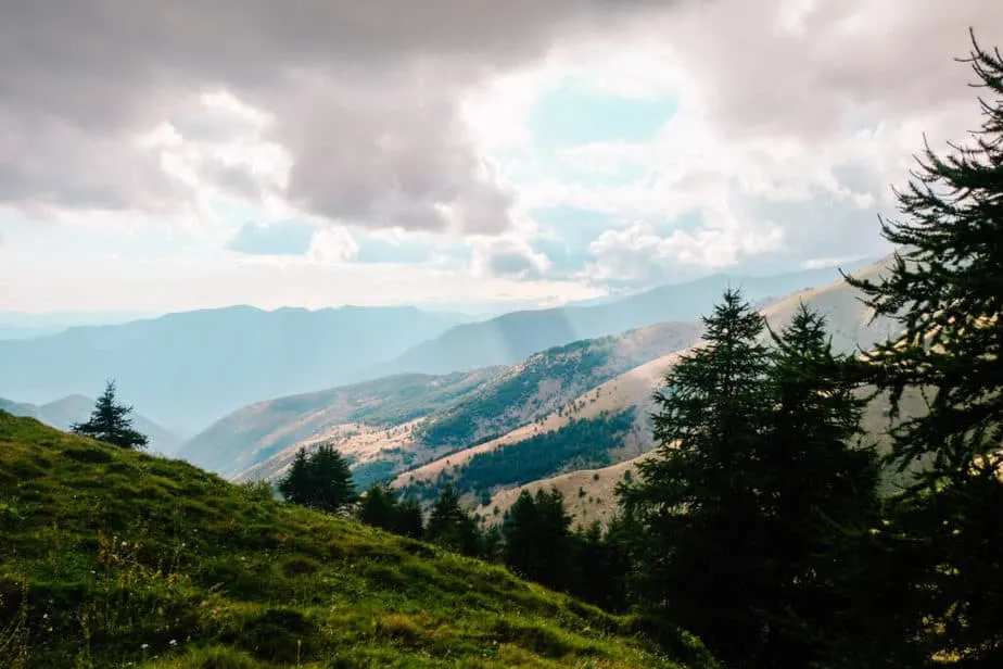
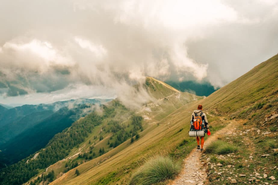
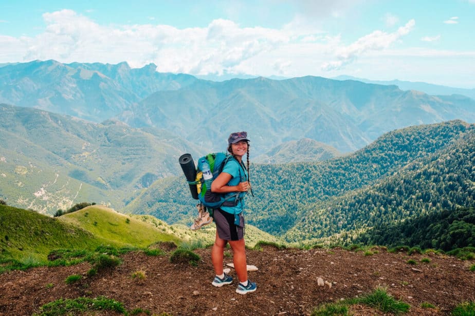
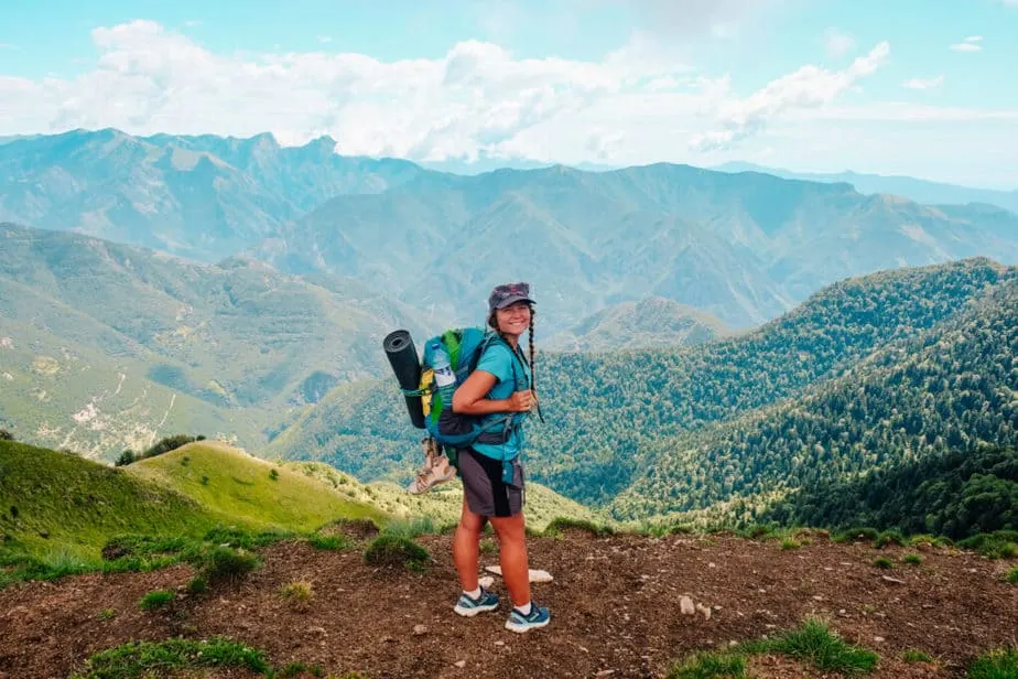
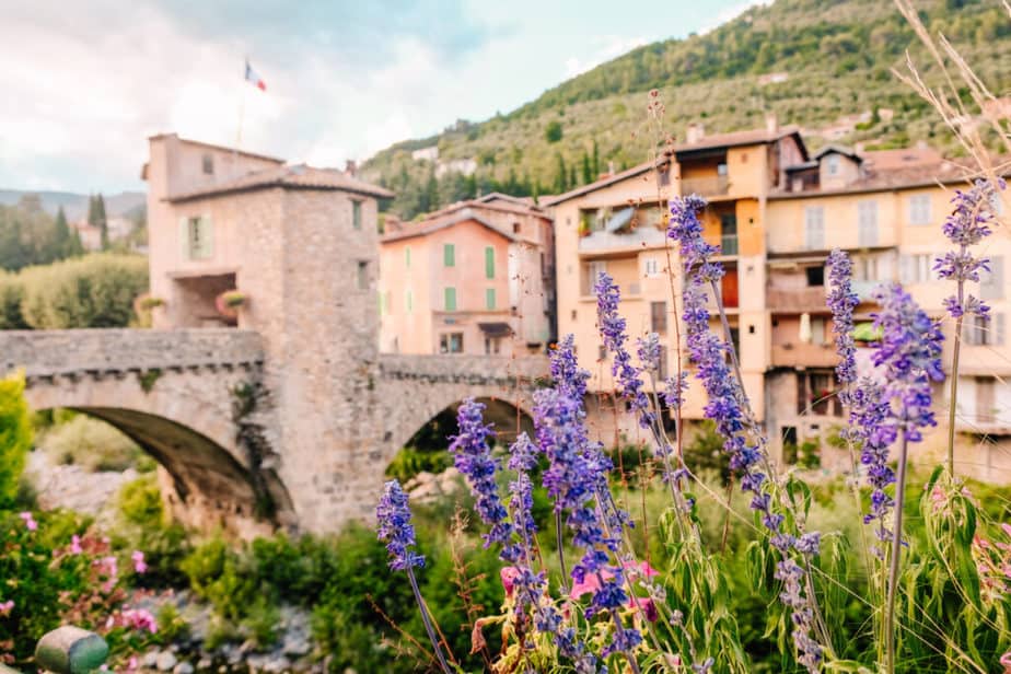
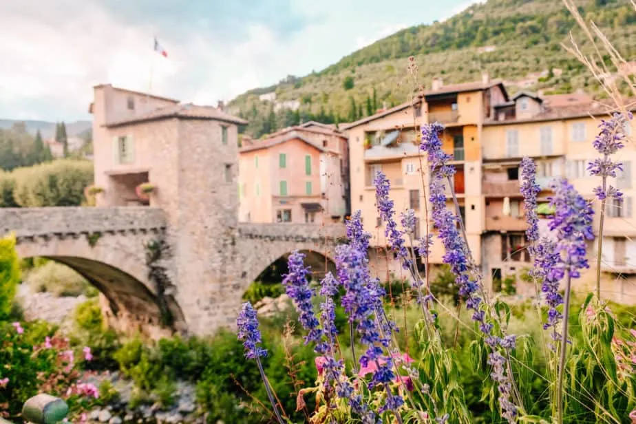
The GR52 is a 6-day-long trek through the most scenic areas of the Mercantour National Park in the South of France. It starts in the mountain town of Saint-Dalmas Valdebore and ends on the sparkling coast of Menton, right on the border between France and Italy. It’s the perfect moderately difficult hike for slightly more advanced trekkers and you can camp the whole way!
Let’s get started!
How Long Is the GR52 Trek and How Many Days Will it Take
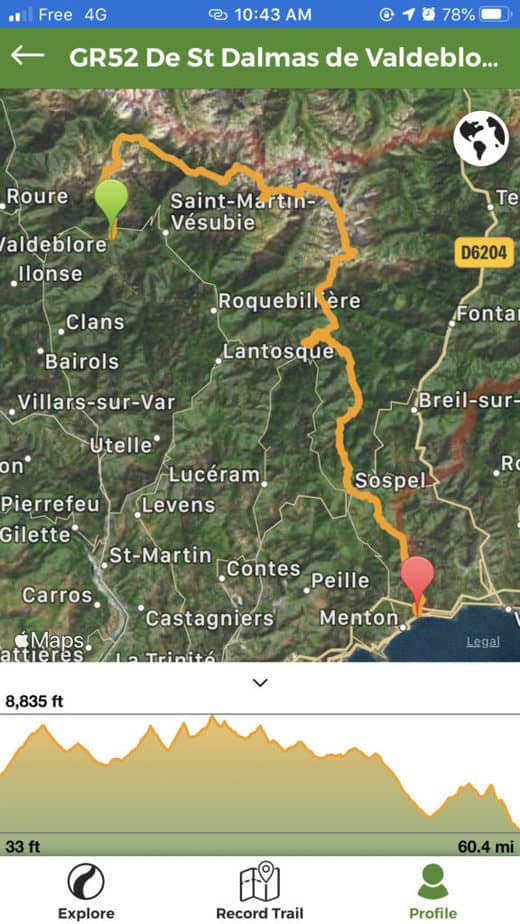
The GR52 is 60.4 miles long and gets up to 8,835 feet in elevation and goes all the way to 0 feet elevation at the beach in Menton. The map below is provided from the official GR52 info website and shows the exact trail.
If you want a more specific amount of elevation gain and loss during specific sections of the hike, you can refer to the map on the Wikiloc website/app (I’ll go over the Wikiloc app more in a bit).

I recommend you set a goal of how many miles you want to cover each day and divide the trail up that way.
I have included our exact itinerary for the GR52 below if you’d like to follow an 8-15 mile per day trek that lasts 5-6 days and gets progressively harder (more miles per day) as you go along.
Start learning French before your trip to France! I’ve been using italki (I’m taking 3 classes per week right now) for years to learn French and Italian from home! Try out a class and you’ll thank me later. They’re usually $9 or less!
How to Train for the GR52 & Who Should Do This Hike
The GR52 Hike is quite difficult, but still okay for beginner hikers (that’s me!). We saw a lot of kids out on day hikes in this area and they were doing great!
However, doing this as a trek is much more difficult than just a day-hike.
To train for the GR52, I recommend that you start hiking every weekend between 7-13 miles in one day with as much elevation loss and gain as you can.
On the days that you can’t hike, try to get as much time on your feet as possible as well as walking at least 10,000 steps a day.
I didn’t walk the 10,000 steps every day, but it definitely wouldn’t have hurt!
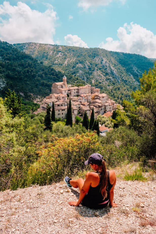
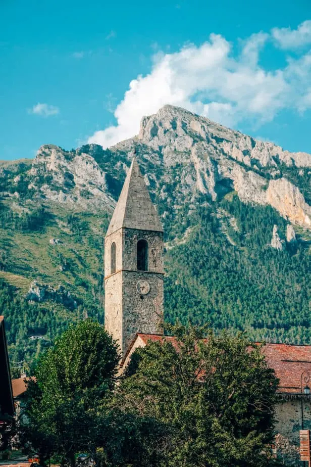
In order to get ready for the hike, we hiked to the Cime de Baudon and all over beautiful hilltop villages around Nice like Peille, Peillon, Aspremont, Mont Chauve, Saint Agnes, Gorbio, and Roquebrune-Cap-Martin.
Another great hike is the hike from Cassis to the Calanques!

We hiked every weekend for about 5-6 weeks before starting the trek. The first few weeks were 6-7 miles on a Saturday or Sunday and then the last few weekends we did 12-13 mile hikes on either Saturday or Sunday (not both days!).
Warning: Don’t do this hike if you have bad knees/ knee problems. There are two days where the descent down the mountain is so steep and painful that any knee problems would definitely be exacerbated.
Wikiloc is NOT Optional: Buy It
Wikiloc is a GPS app for hikers/athletes in Europe that costs $10 per year for offline maps and routes. Our biggest trek mistake was not buying Wikiloc before we ever started. Even while following the GR52 markers, we got off-track by over 6 miles.
We immediately found the next place with wifi and downloaded Wikiloc and followed it religiously the rest of the way.
You can still see the route and elevation on their app/website without paying for a subscription, however, you won’t be able to access the maps offline which is incredibly important while trekking for obvious reasons.
Right now, Mercantour National Park is changing some of the routes of the GR52 so some of the signs are going to be wrong.
I would recommend following the app over anything else, especially since we found that some of the trails marked as GR52 were not GR52.
Whenever you come across a fork in the road, get out the app and MAKE SURE you are going the right way. Then check again once you’ve chosen your direction. This saved us a lot of extra mileage.
What to Pack for the GR52
Whether you live in France or are just on a vacation, whatever you don’t already have for the hike you can get at Decathlon (ah, we love this store!!).
We got sleeping bags for $10, a tent for $25, a pot and silverware for $10, hiking shorts for $10, hiking shirts for $4 each, a stove for about $25, a headlamp for $20, water purifying tablets for $20.
Basically, you don’t need to worry about the cost of this trek. Even if you buy everything new from Decathlon before you leave, it will be one of the cheapest trips you’ve ever taken.
Just make sure to buy the cheapest options!
What Food to Bring
As far as what you want to eat on the trek, that’s completely up to you! Jake and I are NOT camping food people. I could not stomach the dehydrated packets of food, plus they were quite expensive.
So instead, we brought our stove and gas and made oatmeal every morning. For lunch, we took two half-loaves (only in Europe can you buy a half-loaf of bread! lol) and smushed them.
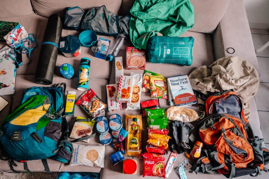

I brought a small jar of peanut butter and a small thing of honey and Jake brought a can of tuna and we had that every day for lunch!
It was easy, although the bread had to be peeled from the other pieces of bread. However, when you’re hiking and hungry none of that matters.
For dinner, we brought rice and packets of ramen, which we would mix together (fully cooking the rice first!) to make what we call “rice ramen.”
We also brought packets of soup and spaghetti noodles. It was delicious and we looked forward to dinner all day!
How to Get to the Start of the GR52 from Nice
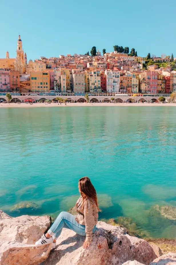
You can either start in Saint-Dalmas or Menton. I highly recommend starting in Saint-Dalmas since it is better to start a huge ascent in the mountain air than in the hot air of Menton.
Plus, there’s something about starting all the way in the mountains and then ending on the beaches of the Cote d’Azur!
From Place Garibaldi in Nice, you take the L2 towards CADAM/Airport and get off at Grand Arenas. From there you walk under the overpass where the bus stop for the 90 bus is.
Although this bus looks a bit more formal, you still only need your Ligne d’Azur ticket to get on. ($1.50 for a solo trip, or $1 if you buy a 10-trip ticket).
When typing into Google Maps, three different Saint-Dalmas will show up. Make sure you choose the Saint-Dalmas Valdebore one!
Also, keep this in mind on your bus ride since you might need to communicate with the bus driver where you are going.
Beware of Animals
Before we get to the itinerary you need to be aware of one last thing that we really struggled with on this trek that we didn’t expect to struggle with: wild animals.
Admittedly, we did little research besides knowing the difficulty/length of the hike and what we were going to see on the way.
Little did we know that in Le Boreon we would wake up to a fox ferociously attacking our tent leaving bite marks on our backpacks and tent and us scared to fall back asleep.
Or that wild boars would wander around our tent just outside of Sospel.
Basically, go on this trek more prepared than we were. Bring a knife or weapon of some sort for emergencies.
Don’t eat inside your tent and don’t sleep with food inside your tent. Hang your food from trees far from your tent and make sure to cook your meals far from your tent as well.
Also, make sure not to pitch your tent on a game trail or too close to a stream as that’s where animals go hunting and to look for water.
Obviously we were complete newbies to all of this, so do your research on how to protect yourself from wild animals while on this trek and others throughout France/Europe!
List of Refuges Along the GR52
Just in case the lightning storms and the animals scare you a bit, you can do this hike from refuge to refuge instead. This may take some extra planning, but here are all the refuges/places to stay along the way to help you.
- Saint-Dalmas
- Le Boreon
- Refuge de Madone de Fenestre
- Refuge de Nice
- Refuge de Merveilles
- Off-Course – Moulinets
- Sospel
- Menton
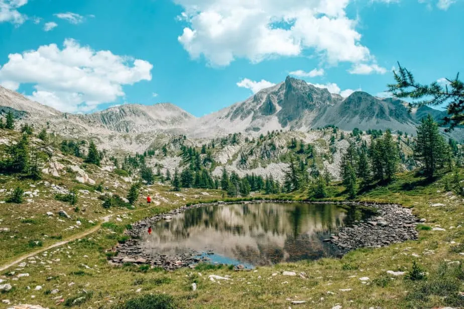
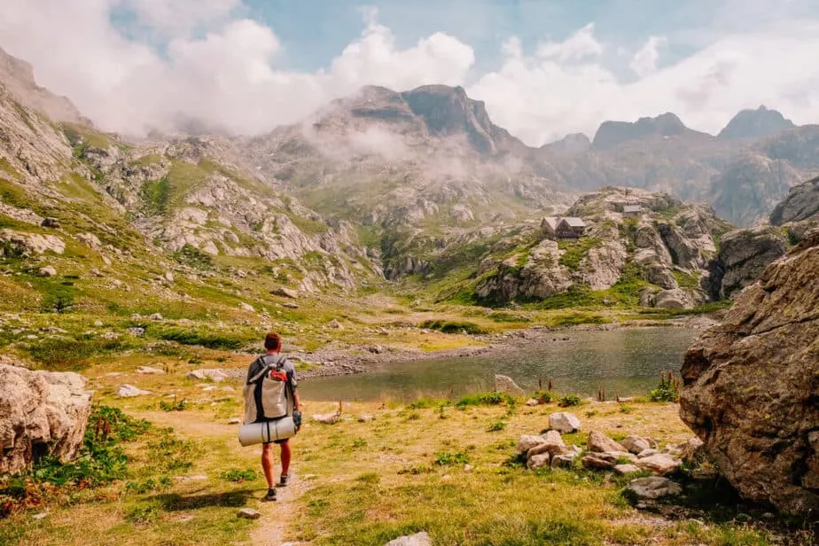
Day 1: Saint-Dalmas- Valdebore to Lac Petit: 4 miles (6.4 KM)
This is the exact itinerary we followed, but the best part of hiking with a tent is the flexibility! You can hike longer or shorter depending on your time limit or the number of miles you want to cover each day.
The bus drops you off at the start of the GR52, but we decided to walk around the city first and get some pictures before we headed out! Once you’re ready to start, head back to the bus stop and the trail starts up immediately (going up, up, up!)

Since we started hiking at 6:30pm (we had work that day and left Nice right after we were done) we only made it to the first lake.
Lac Petit is actually not on the GR52 trail, but it loops up to the same point and we really wanted to sleep at a lake.
This area has a few lakes that you can choose from if you’d like to stop and camp here for the first night!

Total Miles Hiked: 4 (4.4 km)
Miles Left: 56.4 (90.7 km)
Day 2: Lac Petit to Le Boreon: 8.5 miles (13.6 Km)
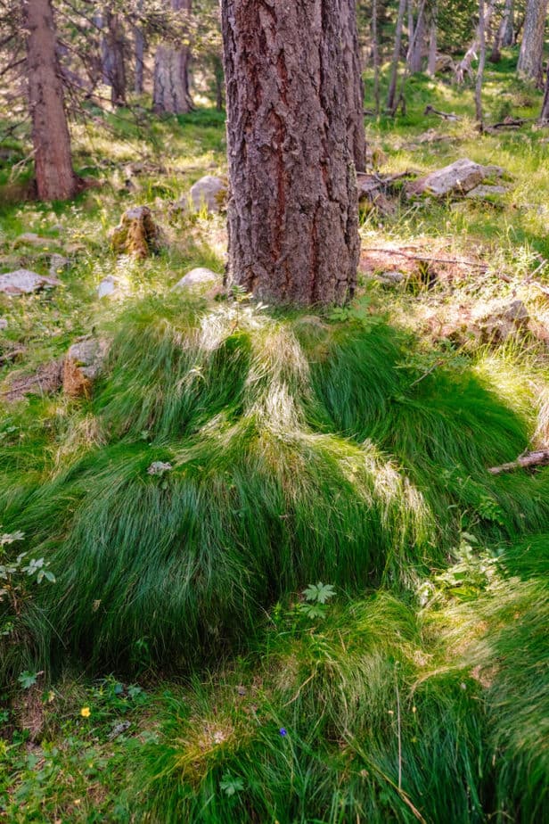
On Day 2, we went from Lac Petit to the small town of Le Boreon. The area around Lac Petit is filled with beautiful lakes, although most of them are too small and a bit too dirty to swim in. (Don’t worry, there are lots of lakes on the GR52!)
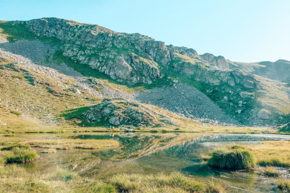


After the lakes, you start heading down into a valley surrounded by giant mountains until you get to a small farm area.
There is a slight ascent after that until you hit a road and you can choose to turn right or left. Make sure you check your phone as this is where we got off-track!

Total Miles Hiked: 12.5 (20.1 km)
Miles Left: 47.9 (77 km)
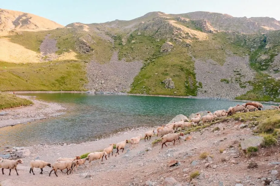
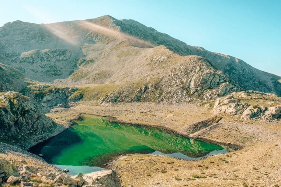
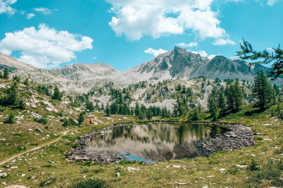
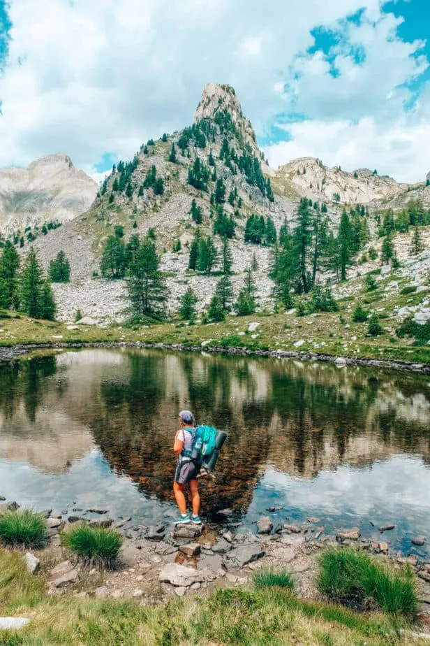
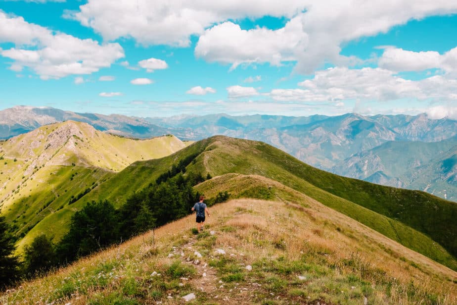
OPTIONAL Off-Route Hike to Lacs Fremamorte: 6 Miles
Instead of turning right at the top of the path that brings you up from the small building and farm area, we accidentally turned left and followed markers up to some incredible views that led straight to the border of Italy.
This optional side-hike is about 6 miles long and has streams, lakes and giant beautiful mountains all along the way.

You can choose from looking at these photos and judging whether you think you’ll be able to add a bit of extra mileage onto your 60.4-mile trek.
Of course, Jake and I didn’t mean to go this way but we actually had no idea that it was the wrong way until after we had enjoyed most of the trek.
It was some of the most beautiful scenery I had ever seen, so even though I did break down (I’m a crier) since I knew we had added an extra 6 miles to our trek, I was still grateful that we got to see this area.
I also knew that I would have never chosen to go here if it weren’t on accident since it added so many extra miles, so it was kind of a blessing in disguise!


Day 3: Le Boreon to Refuge de Madone de Fenestre: 7 Miles (11.2 km)
From Le Boreon you have your longest ascent ahead of you, which is why there is less mileage on this day. It took us about 7 hours to complete the ascent.
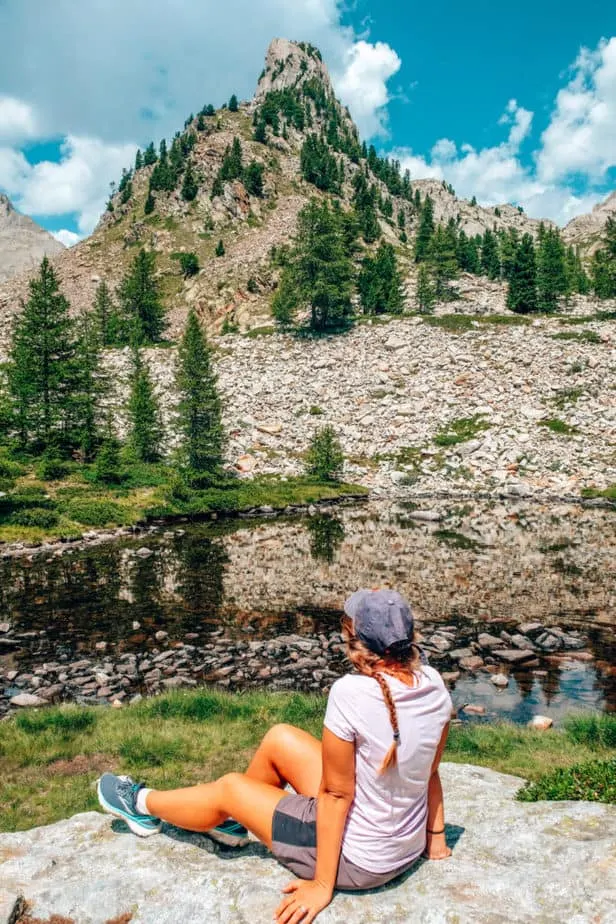
One of the best views of the whole hike is on this day, when you pass by a gorgeous lake with an actual ISLAND in the middle!
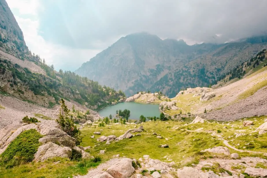
It seemed like most people were on day-hikes up to this lake from Le Boreon. There were also tons of streams and rivers along the way where people stopped to go swimming.

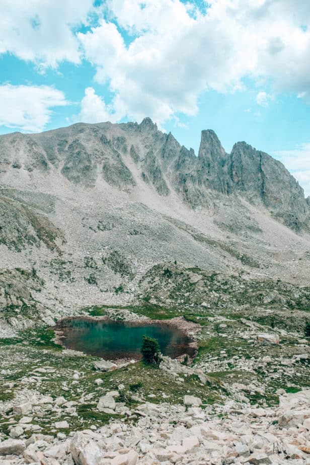
Once you get to the top of the ascent over Lac de Trecolpas, you get your first real taste of mountains above the tree-line before descending back down into Madone de Fenestre.
There were signs that said we couldn’t camp in this area, but we spotted quite a few other campers and just camped anyway.
Total Miles Hiked: 19.5 (31.3 km)
Miles Left: 40.9 (65.8 km)
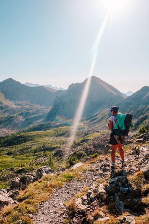
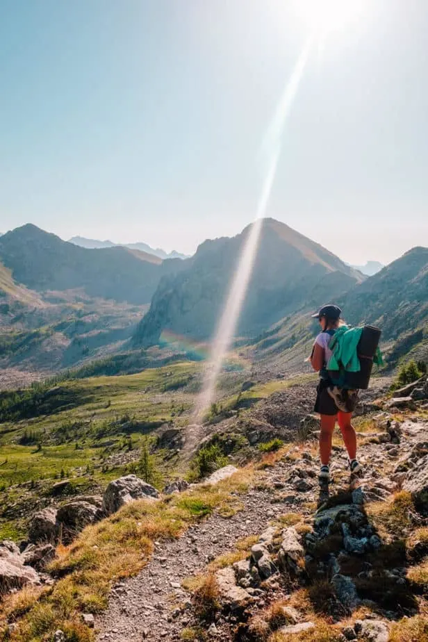
Day 4: Madone de Fenestre to Fort at Baisse de Saint-Veran: 13.7 Miles (22 km)
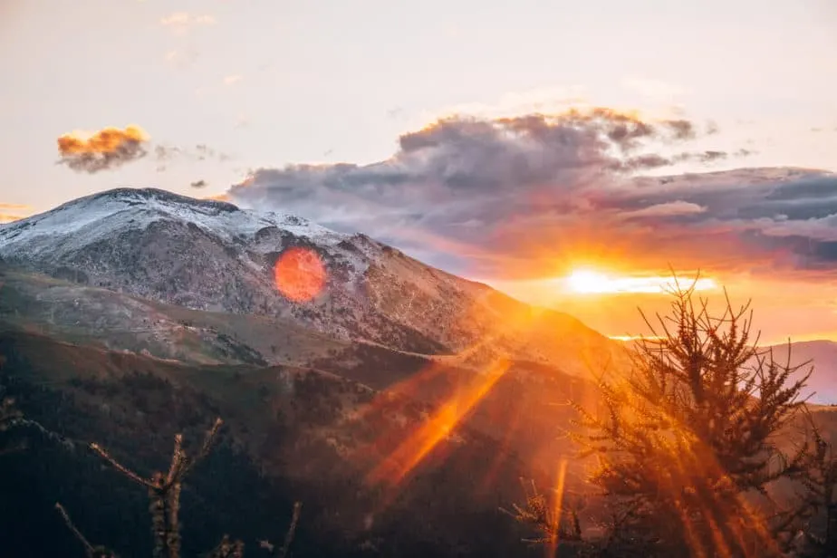
From Madone de Fenestre all the way to the Baisse de Saint-Veran, you are above the tree line. This is the most dangerous part of the hike and you’ll need to keep watch of the skies and if you hear thunder you should get cover.
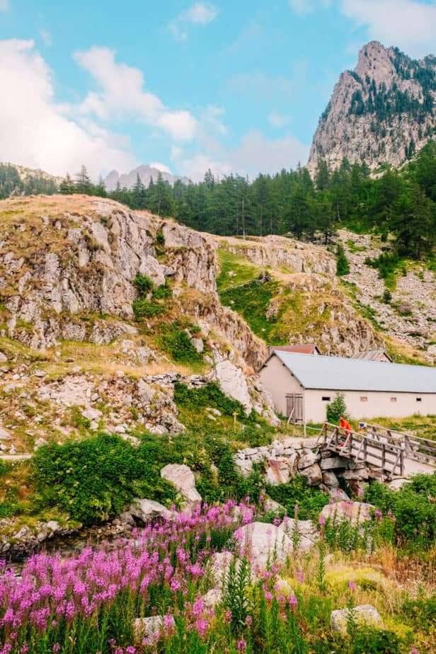
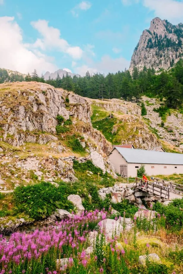
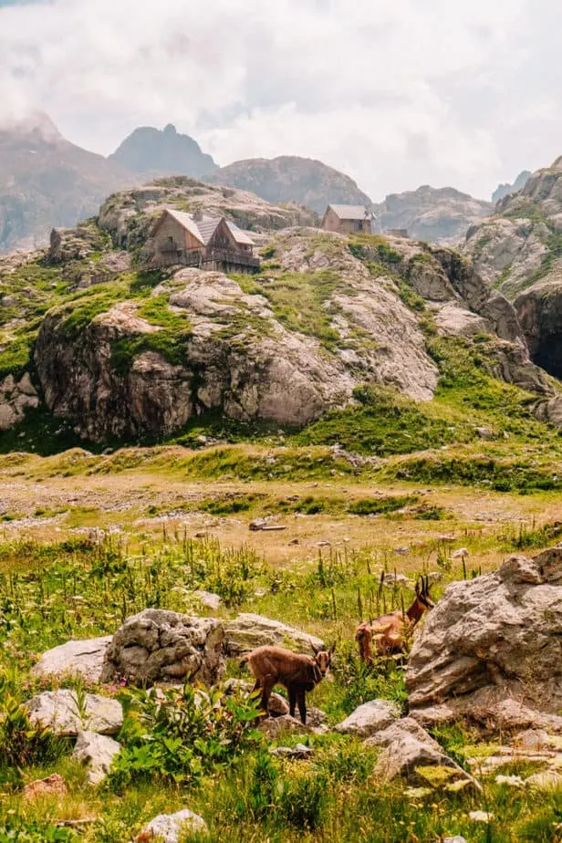
Luckily, this area has a lot of refuges and is also incredibly beautiful which makes it worth it!
Refuge de Nice
The first refuge you’ll pass by is the Refuge de Nice, which I have to say is the most idyllic place I think I’ve ever been to. Streams, waterfalls, deer, lakes, flowers, it was straight out of heaven and it was so serene; my favorite part of the hike.


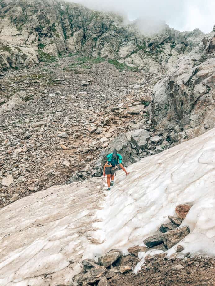
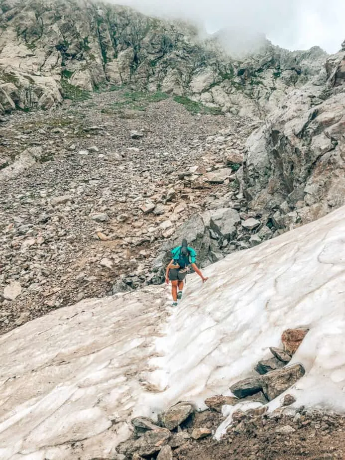
After the Refuge de Nice, you start heading back into mountain lakes and you may even see snow! (We went in early August.)
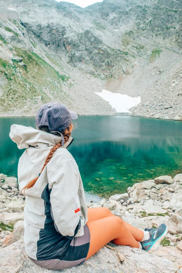

Even in early August, we still had 3 snow crossings on the hike. This first one was the only one I was worried about since there was a bit of a drop-off and my shoes are NOT hiking shoes.
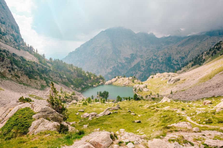
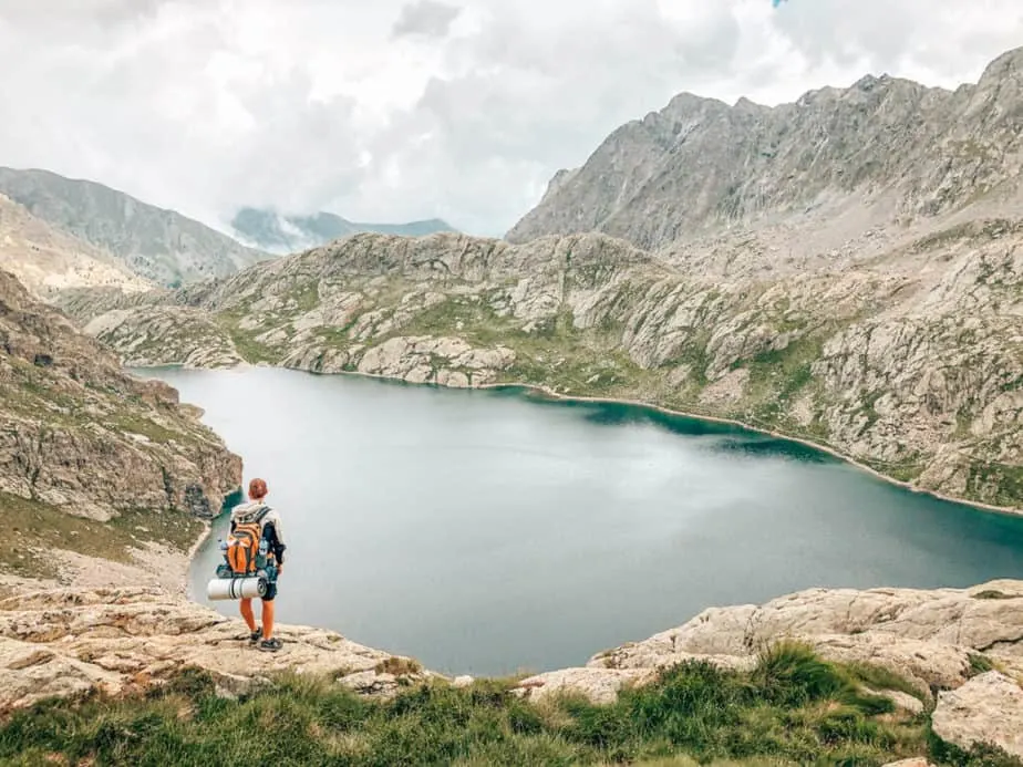
The most beautiful lake (and the largest) of the whole GR52 trek is Lake Basto. It is also right between the two highest ascents of the hike, so you really feel like you’re working hard!

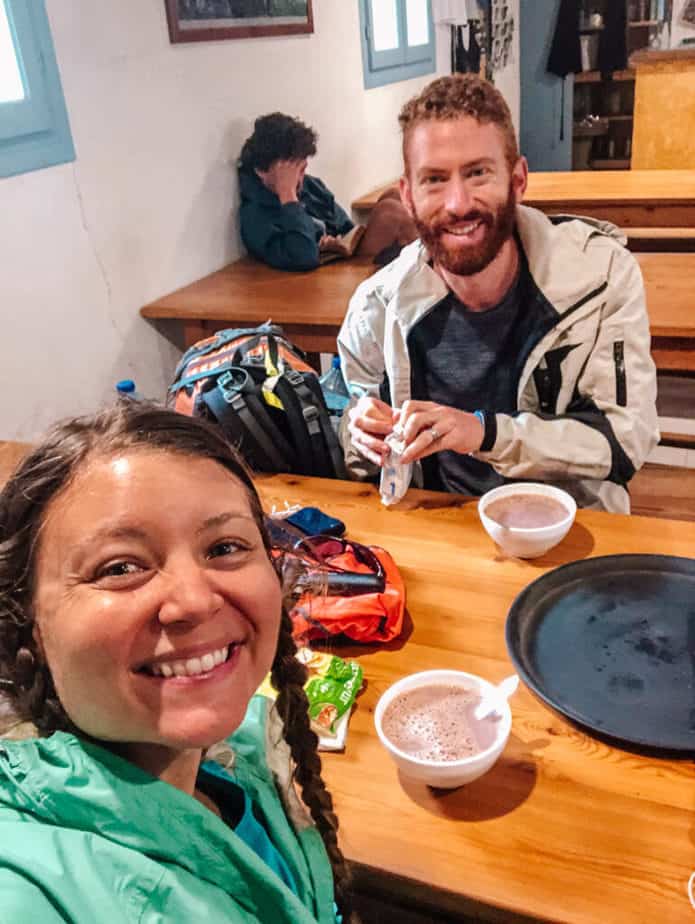
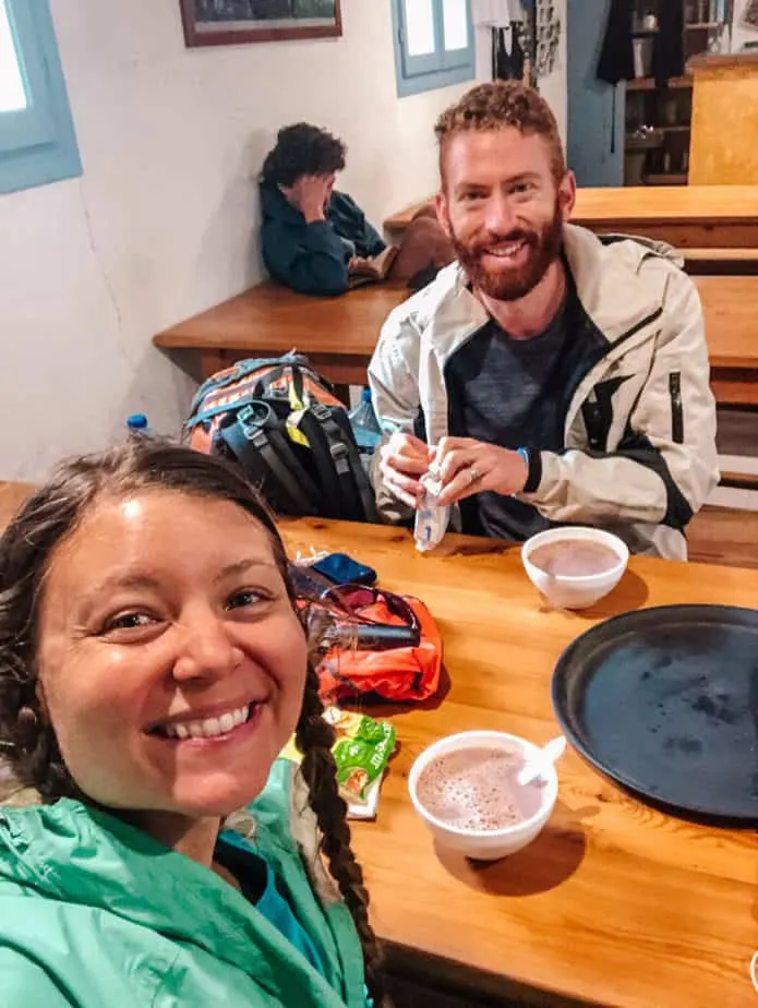
We didn’t stay at any refuges, but a storm hit as we were leaving Lake Basto so we made it as quick as we could to the nearest refuge.
It was the only refuge we went inside on the whole trek, but it was a well-needed break! They served hot chocolate in giant bowls and it was perfect!
After the Refuge des Merveilles, we kept hiking (although we shouldn’t have, there was a storm coming in!) and made it to the Baisse de Saint-Veran.
From there, we spotted a fort and an area that looked like there were enough trees to protect us from a lightning storm and headed there quickly.
This day is probably a bit too long/too much mileage and I would split it into two. We just wanted to get to the tree-line as soon as possible.

Total Miles Hiked: 33.2 (53.4 km)
Miles Left: 27.2 (43.7 km)
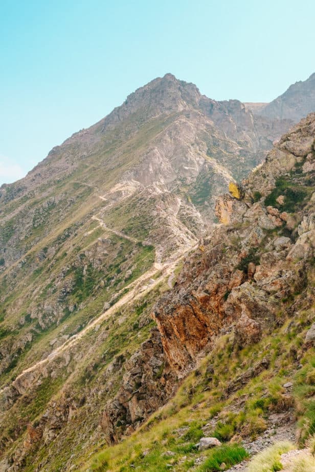
Day 5: Fort at Baisse de Saint-Veran to Sospel: 16.8 miles (27 km)
From Baisse de Saint-Veran we started hiking down to the only official village along the whole GR52 route: Sospel. This is a day that you will need to prepare yourself for.

The first half of the day is the same as the other days, little ascents and descents through beautiful terrain, but this time you are descending a bit more than ascending as you get further down into the tree-line.
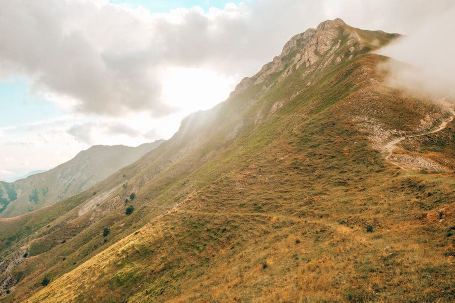


However, once you get to the incredible mountain views that last from Baisse de la Dea to another viewpoint that shows every mountain you’ve conquered up to this point… from there you start a terrible descent that is absolutely relentless.

The descent is about 6.5 miles long and it took us over 7 hours. Of course, if this was just a day-hike I don’t think that the descent would have felt as brutal.
However, after hiking huge mountains for the past 4 days, my legs were cramping and we took more rests on that descent than we probably had the whole rest of the trek. Just prepare yourself for that huge descent.
It may not be the case for you, but in my case, the descents show you every area on your body that you’ve made sore while trekking. My calves seized up and my toes lost feeling.
Plus, just the monotony of only going down for hours and hours while feeling like it may never end or that we weren’t getting any closer was pretty brutal (and only slightly LESS brutal than what waits for you tomorrow!)
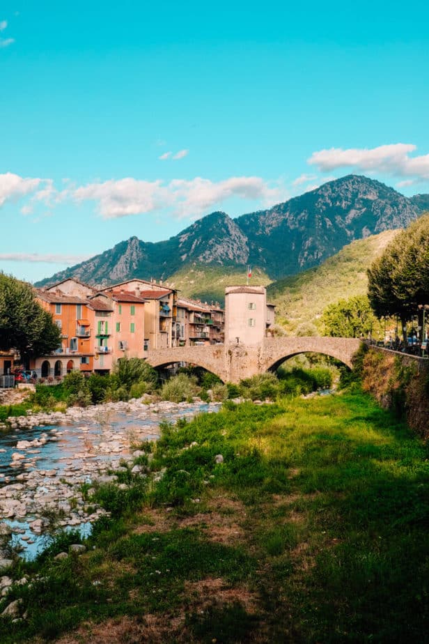

Sospel is such an adorable and beautiful town, so even with our aching feet we made sure to explore a little and pick up some snacks here.
The locals are so kind and quite a few came up to us to tell us they had done the GR52 and to warn us about getting more water.
WARNING: From Sospel all the way to Menton there was NO WATER AVAILABLE. Whatever you get in Sospel will be all you have until the end of the hike (at least at the beginning of August this was our experience).
MAKE SURE you bring extra water or even buy a few more bottles of water while in Sospel.
Total Miles Hiked: 50.4 (81.1 km)
Miles Left: 10.4 (16.7 km)
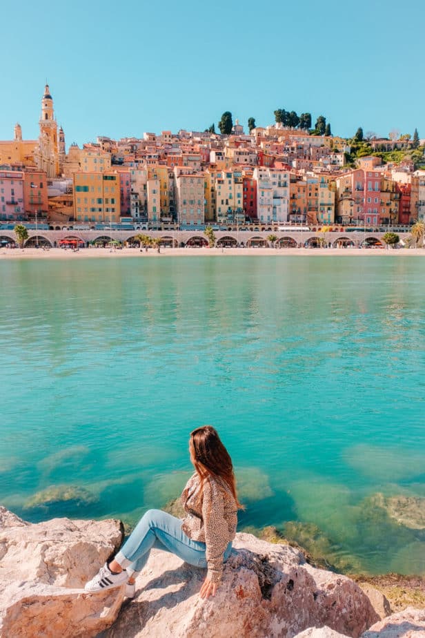
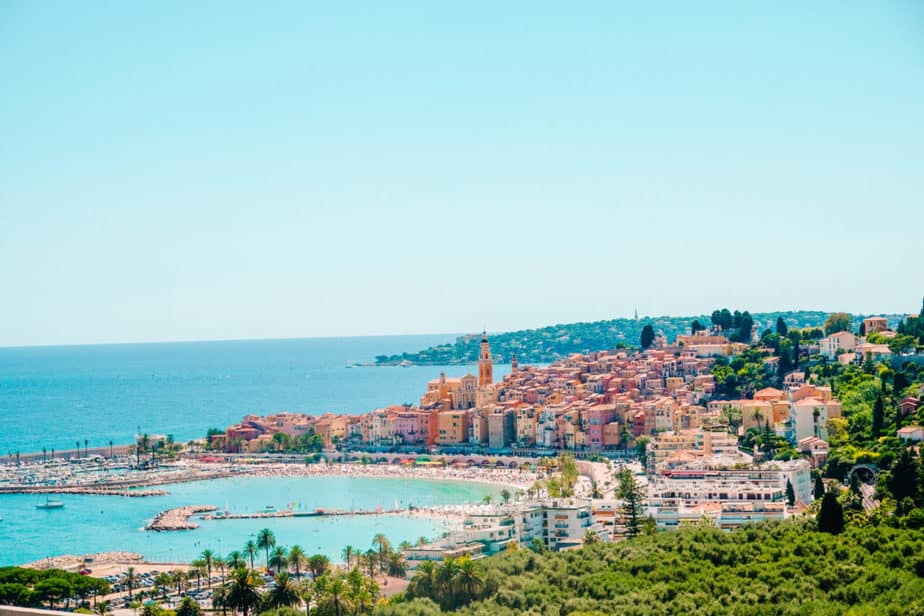
Day 6: Sospel to Menton: 10.4 miles (16.7 km)
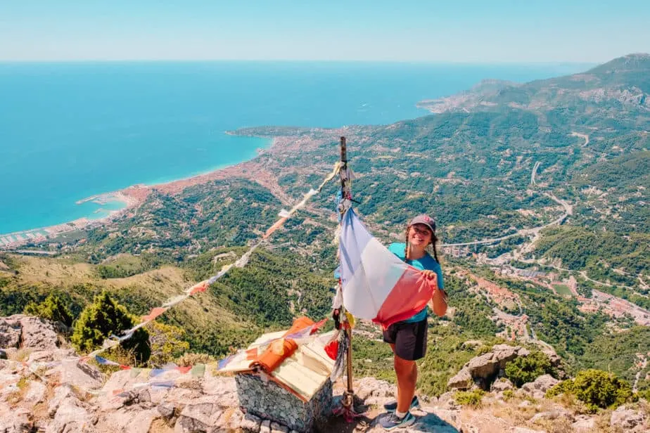
The LAST DAY OF THE TREK! This day includes the most brutally steep descent of the whole trek, but with a great reward at the end: the finish line!! It’s a day of lasts, last big ascent and last big descent.
Throughout the day you’ll be able to motivate yourself to keep going with views of Menton and Monaco visible below you.

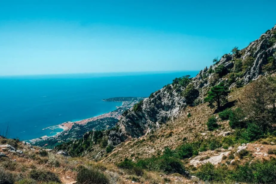
Once you finish the last ascent of the hike, you get to a meadow where you can see Menton and you’ll be able to rest a bit. From there, you can leave your backpacks and head up the small mountain to the right to get to an even better view of the coastline.

After you’ve visited the viewpoint, it’s time to start the terribly steep descent (3,000 feet in 3 miles) to Menton.
As you descend, the views of Menton will get better and better as the weather also gets hotter and hotter (you’ll be grateful you’re not doing this hike backwards!)

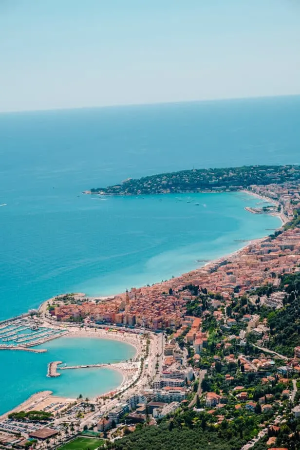
The end of the hike is at the Gare Garavan in Menton, but if you feel up to it, I recommend walking down to the nearest beach (Plage Rondelli) and jumping in.

You made it all the way from the mountains to the ocean!
More About the Trails in Nice:

Dayna Brockbank is a travel and language-learning blogger who has lived around the world but has now settled in Nice, France. She speaks 3 languages at varying levels of fluency: Spanish, Italian, and French, and graduated with a Bachelor’s in Spanish Education. She and her husband focus on making travel part of life by living cheaply and traveling on a budget.
Federico
Thursday 19th of May 2022
Hello, thanks for such a detailed description!! I was wondering how frequently during the route is possible to find drinkable water. I was wondering how drastic could be the water management.
admin
Tuesday 24th of May 2022
Hey Federico! We didn't have much problem finding water until the last few days. There isn't water until you hit Sospel and then after that, it's hard to find water till you get to Menton. So I wish we had prepared better for those days.
Seb
Thursday 27th of May 2021
Hello, thank you for the detailed post! What were the temperatures at night in August, especially higher up in the mountains? I am not sure what sleeping bag I should bring for sleeping in a tent.
admin
Thursday 27th of May 2021
That's a great question! It definitely depends on how high up you end up sleeping. We slept above the tree line twice in the cheapest sleeping bag they had at Decathlon (which was for 20 degress celsius). I definitely wore all my layers though while sleeping, but I don't remember the cold being a huge problem once I actually fell asleep. The hardest part is getting your feet to warm up! I slept completely inside the sleeping bag (covering my face and everything) when it got too cold. However, my husband never had a problem with it and often slept on top of the sleeping bag instead. The cheaper sleeping bags were also much lighter. I hope that helps!
Megan B
Monday 10th of August 2020
Such a comprehensive post! Loved the detail and wish we could go do this hike! What an adventure!!!
admin
Monday 10th of August 2020
Thank you! It was a super intense hike but definitely an adventure! We'll have to take you guys on some easier ones when you come visit!! (: