
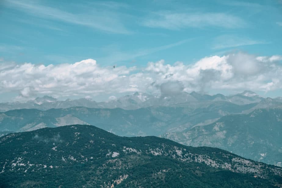
Cime de Baudon has an elevation of 1266 meters (4,153 feet) and is a wonderful day-hike that can be done from 4 different hilltop villages located on the Cote d’Azur. From the top of Cime de Baudon you can get incredible views of the whole coast of Nice all the way down to Menton as well as the Alps behind you.
How Long is the Hike to Cime de Baudon
The most popular(and easiest) way to do this hike is from Peille. The hike is only 1 hour and 20 minutes long each way from Peille Village and it is 7.6 km or 4 miles total.
How Difficult is the Hike to Cime de Baudon
The hike to Cime de Baudon is moderately difficult because the ascent can be quite steep and rocky at times. The whole way up is pure ascent, although you pass through two small openings where you can rest on the way up.
Start learning French before your trip to France! I’ve been using italki (I’m taking 3 classes per week right now) for years to learn French and Italian from home! Try out a class and you’ll thank me later. They’re usually $9 or less!
Best Time of Day/ Year to Hike
Welcome to Nice, France where there is almost NEVER a bad time to go hiking! We did this hike in July around 10 am on a somewhat cloudy day and had no problems with the heat. You may want to start hiking earlier if you are worried about getting overheated.
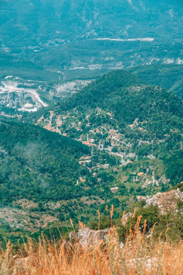
During the summer, you can see the mountains in the distance and the coastline below (although when we went it was a white-out from the clouds) but in the winter you can see the mountains covered in snow! I plan to do this hike again in the winter to be able to see the snow-capped mountains.
Where to Start the Hike to Cime de Baudon
You can start the hike to Cime de Baudon from 4 different hilltop villages in the area. Here I have them ranked from easiest to hardest to help you decide where you’d like to start.
I recommend starting from one village and ending in another so that you can experience more than one hilltop village plus the Cime de Baudon for the same amount of walking.
If you plan to move to France or just want to understand the French better, definitely read this book or this book before your trip! Trust me, it will make your transition and understanding of French culture so much better.
Easiest Place to Start: Peille Village
Peille Village is the easiest place to start the Cime de Baudon hike. The hike is only 4 miles total from this village and the village is very easy to get to from Nice by bus (on Sundays only).
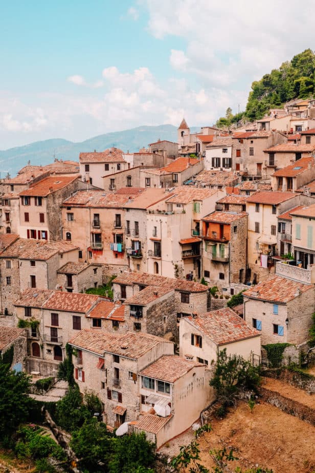

The hike starts right behind the main church of Peille and leads all the way up through the forest to the top of Cime de Baudon. The area is absolutely beautiful and we even had a few deer cross our path on the way!

There are two trails that lead up to Cime de Baudon as well. The best way to go is by passing through the small meadow (there may be campers here) and following the sign and markers to the top.
You can use Google Maps or the app Wikiloc to make sure you are on the right path.
Second Easiest: Sainte-Agnes
Another way to get to Cime de Baudon is by starting at the village Sainte-Agnes. The hike is almost the exact distance and time as the hike from Peille (3.5 km and takes 1 hour and 15 minutes ONE WAY) but the main trouble would be figuring out how to get to Sainte-Agnes.

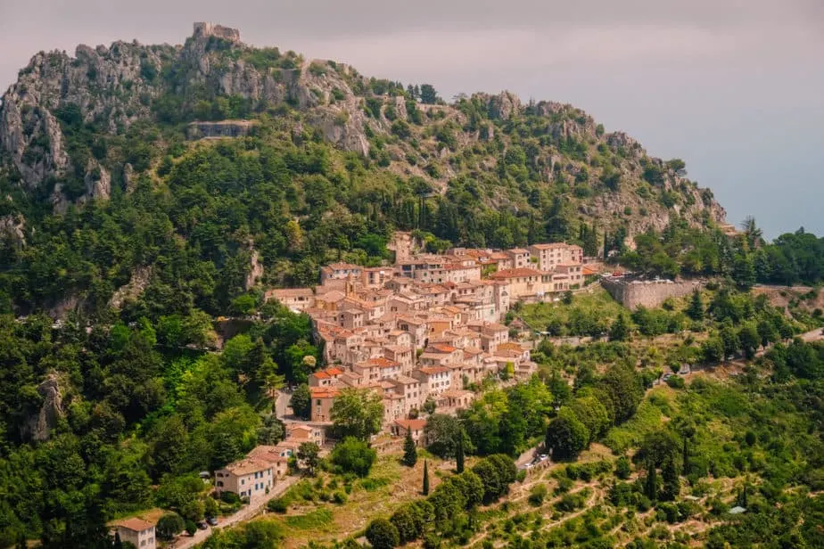
From Nice, there is no public transport to Sainte-Agnes. You will most likely have to travel to Menton first and then take a Zest Bus to Sainte-Agnes.
They are like Ligne d’Azur buses but they are run privately and it costs about $1.50 for a single ticket.
Third Easiest: From Gorbio
From Gorbio, the hike is a bit longer at 4.7 km each way(2.9 miles) and takes 1 hour and 20 minutes (2 hours and 40 minutes total hiking).
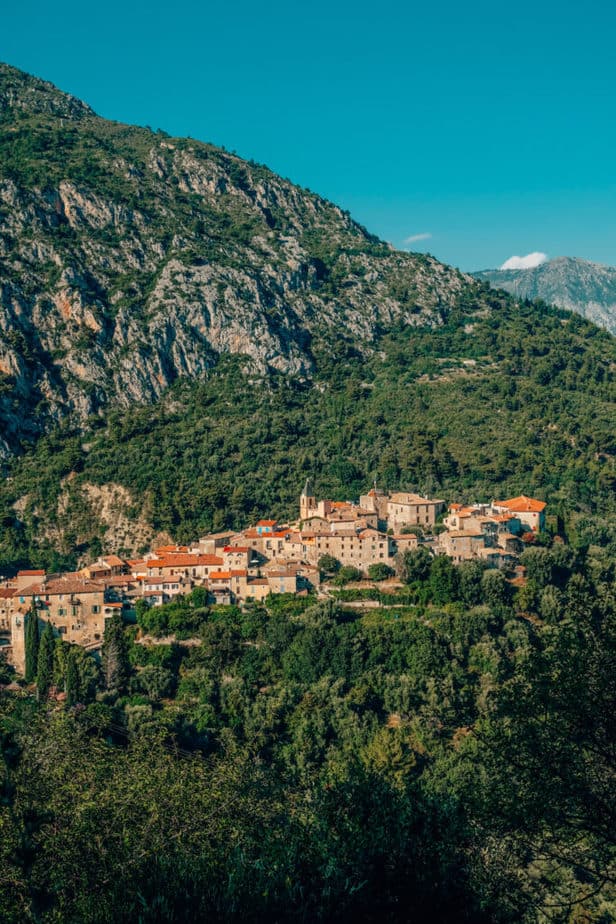

From Nice, there is no public transport to Gorbio (just like Sainte-Agnes). You will most likely have to travel to Menton first and then take a Zest Bus to Gorbio.
They are like Ligne d’Azur buses but they are run privately and it costs about $1.50 for a single ticket.
Most Difficult: From Roquebrune-Cap-Martin
The hike from Roquebrune-Cap-Martin would be about 2 hours and 40 minutes to get up to the Cime de Baudon and about 5 hours total hiking. It is 11 km each way (6 miles each way) and it would almost be completely uphill the entire hike up to Cime de Baudon.
The benefit to starting here would be that you can get to Roquebrune-Cap-Martin from Nice by the TER train to Carnoles. It would add on about 15 minutes of uphill walking on stairs to get to the village before being able to start your hike.
How to get to Cime de Baudon from Nice
From Nice, the easiest way to get to Cime de Baudon is by taking the L1 metro “Hôpital Pasteur” to Pont Michel and then take Bus 66 to Peille Village. However, this is only available on Sundays.
The next best options are traveling to Menton by TER and then taking a Zest bus to the other cities mentioned above.
The Top of the Hike
At the top of Cime de Baudon, there are two separate viewpoints that you should hike to. The official top of the Cime de Baudon is the one that has a giant compass on a table that points to different mountains in the area.

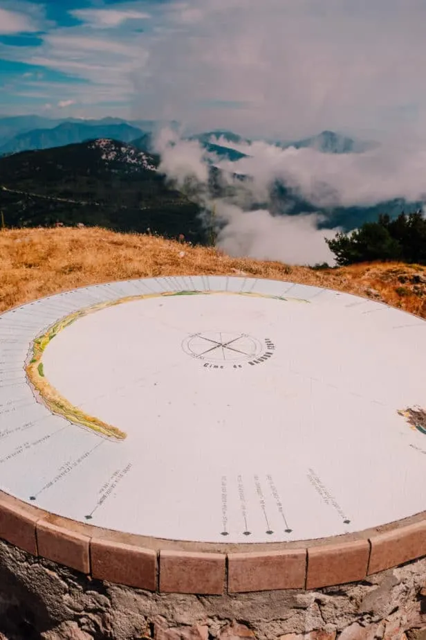
The second one will give you incredible views more towards Nice and Peille down below.


How to End the Hike
To end the hike you can head back down to where you started (Peille, Sainte-Agnes, or Gorbio) or you can hike and end in any of those towns instead!
We started the hike in Peille and hiked all the way to Roquebrune-Cap-Martin. Although this was the easier route (I’d never want to do this backward!) it took us over 8 hours and we were exhausted by the end.
However, we hiked through 4 incredible hilltop villages in just one day!
More About Hiking in Nice:


Dayna Brockbank is a travel and language-learning blogger who has lived around the world but has now settled in Nice, France. She speaks 3 languages at varying levels of fluency: Spanish, Italian, and French, and graduated with a Bachelor’s in Spanish Education. She and her husband focus on making travel part of life by living cheaply and traveling on a budget.