
The hike to the fort on the top of Mont Chauve will give you some of the best views of the entire coast of Nice, France. It is very easy to get to by bus and only a short (yet uphill) hike to the top. Here is exactly what you need to know to be able to hike Mont Chauve in Nice.
How Long Is the Hike to Mont Chauve
From the top of Aspremont (where the church is) the hike to Mont Chauve will take a little less than an hour and a half.
The hike is 4.4 km long to the top of Mont Chauve and another 4.4 km to get back down to Aspremont if that’s the way you choose to go. The way back will be slightly faster since it is all downhill.
There are more options for the length of the hike that I will cover later in this post.
Start learning French before your trip to France! I’ve been using italki (I’m taking 3 classes per week right now) for years to learn French and Italian from home! Try out a class and you’ll thank me later. They’re usually $9 or less!
Difficulty of Hiking Mont Chauve
The entire hike up to Mont Chauve is uphill and the fort at the top is at an altitude of 853 meters. The beginning of the hike is on a trail and then it turns into road. The road winds back and forth until you reach the top of Mont Chauve.
Since most of the hike is on asphalt, I recommend hiking earlier or later in the day. We hiked in the middle of the day and the heat from the pavement was pretty unbearable.
I would say that this hike is easy to medium difficulty depending on the time of day that you do it. It is entirely uphill on the way up and the winding roads seem to go on for a while especially in the heat.
Where to Start the Hike to Mont Chauve, Nice
The best place to start the hike to Mont Chauve is in Aspremont Village. From there you head down the hill to leave Aspremont.
You’ll see a small children’s playground and to the left of that is where the trail starts. The first half of the trail leads you up to a viewpoint of Aspremont.
It’s called the Chemin de la Valliere. You’ll see a sign like this to let you know you’re on the right path:
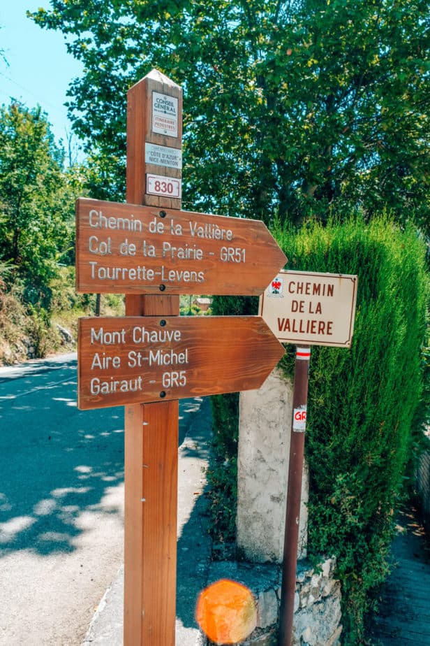
The second half of the trail is from the Aspremont Viewpoint up to Mont Chauve d’Aspremont. Although Google Maps suggests taking the 2.4 km route, I recommend you stay on the trail that led you to the viewpoint and head up the 3.1 km route.
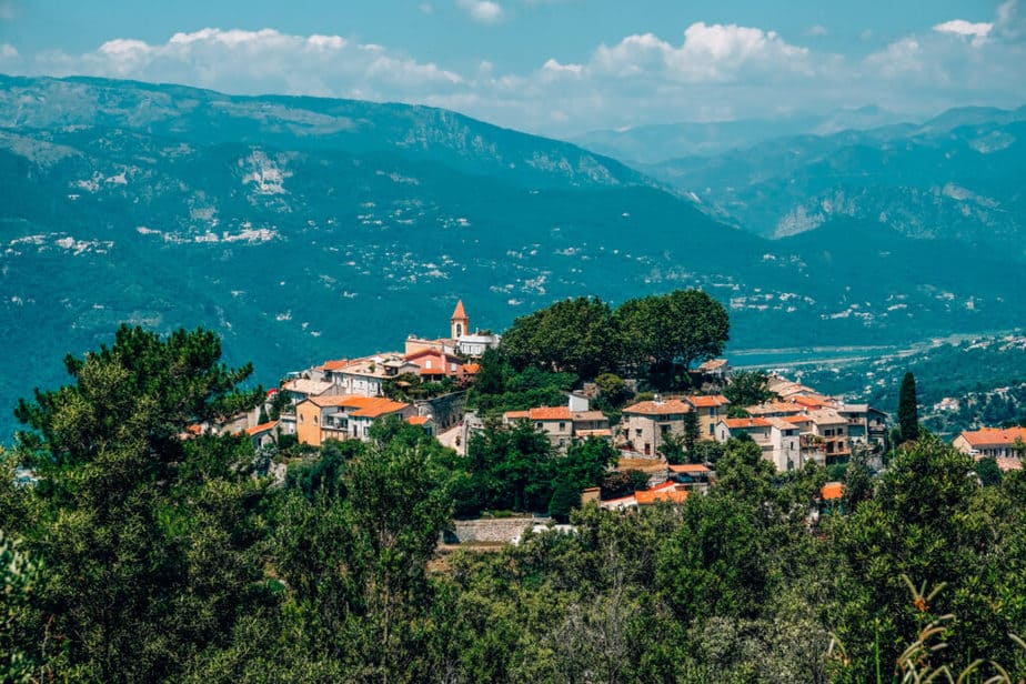
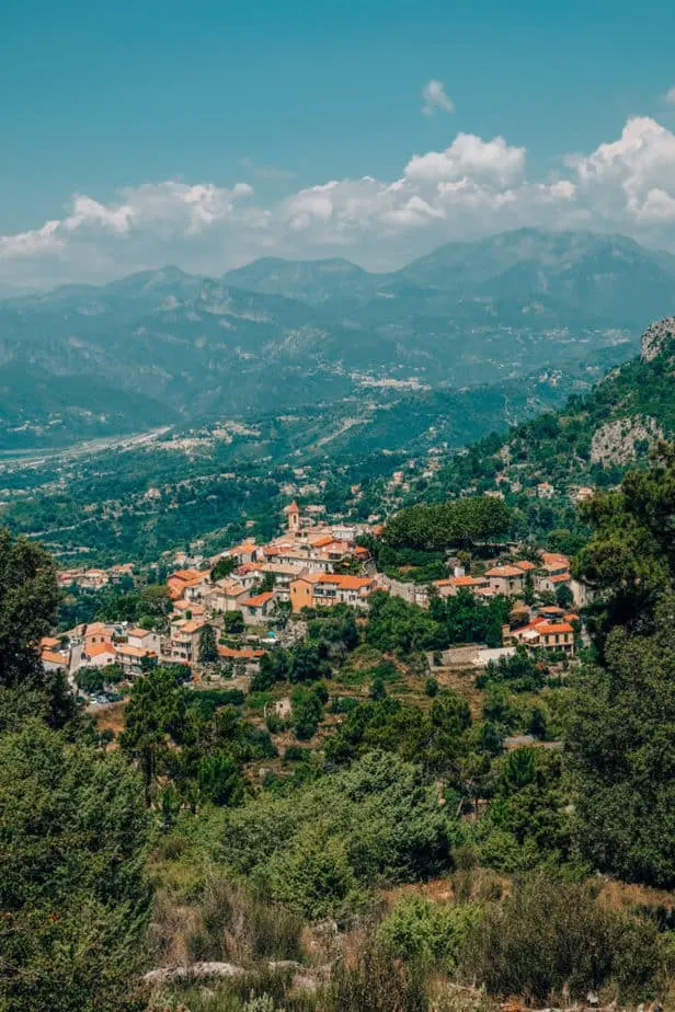
Viewpoint of Aspremont On the Way
One of the best parts of the hike is getting an incredible view of Aspremont on your way up! I dropped a pin on the map to make it easier to find, however it may not be exact.
Near this area, start heading in on smaller trails until you get a good view of Aspremont.

The Trail to Mont Chauve
Once you get to the giant dumpster covered in graffiti, you are at the start of the hike up Mont Chauve. There is a small wooden sign that will direct you to start heading up!
At first, the trail is dirt, but then it turns into an asphalt road that winds up to the top of Mont Chauve.

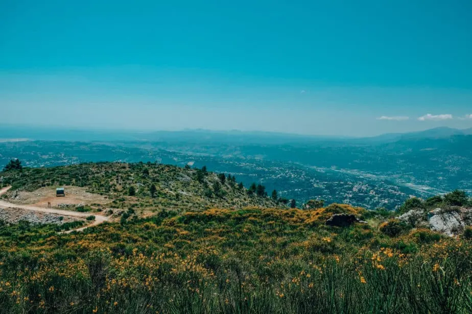
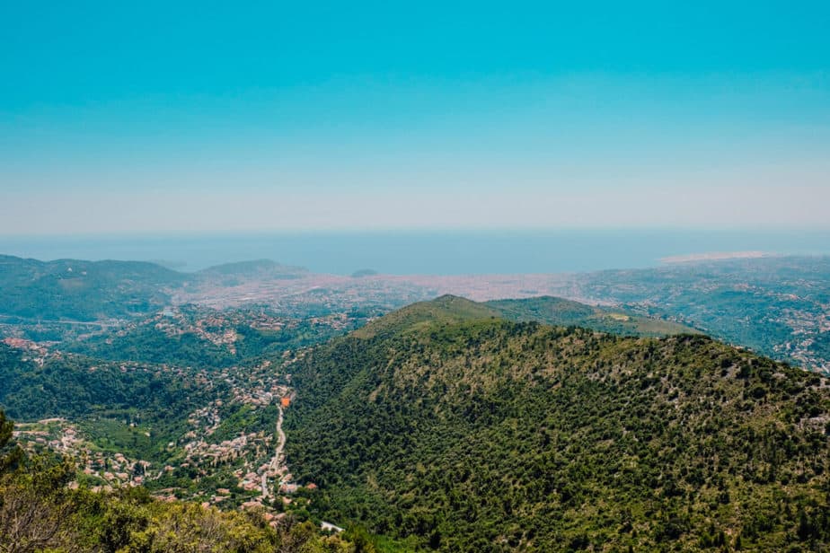
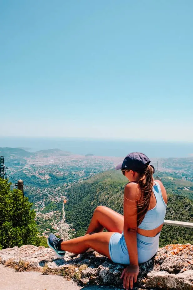
The Views On the Way Up to Mont Chauve
As you wind your way up the hill (it seems to never end!) you have incredible views of the whole coast of Nice!

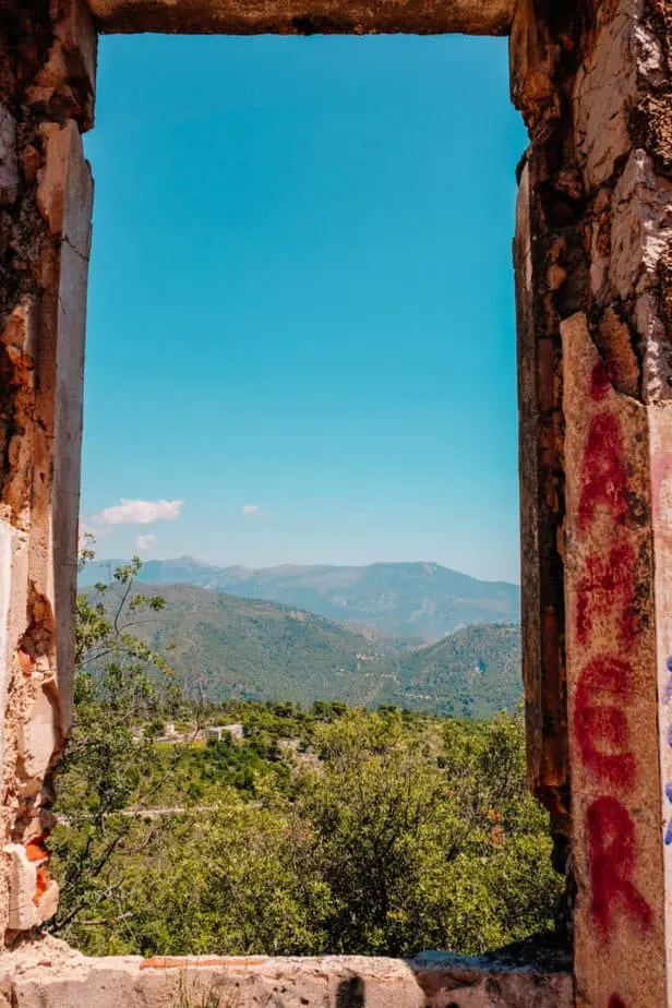
The Abandoned House: Half-Way Point
A little more than halfway up Mont Chauve there is an abandoned house. In itself, it’s not very impressive but it was a good way to break up the hiking for a bit.


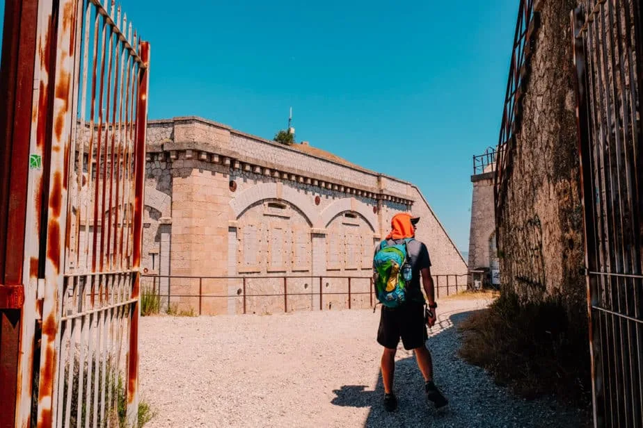
The Top of Mont Chauve: The Fort
At the top of Mont Chauve, there is a very creepy, old fort that was built in 1885. The whole area is a bit scary to explore and feels a bit like a prison.
However, you aren’t there for the fort! You’re there for the views of Nice!

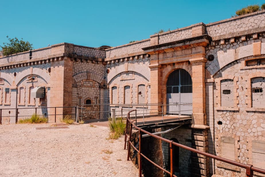
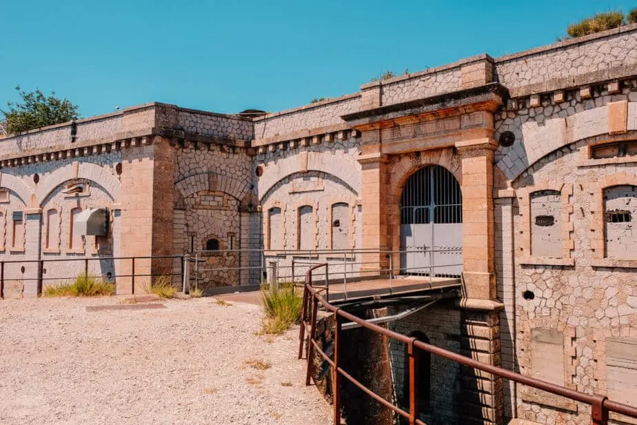
To the right of the front gate, you will see a set of stairs that leads up to a big platform. Here is where you can get the best views from the top of Fort du Mont Chauve.

How to Finish the Hike to Mont Chauve
Back to Aspremont
From the top of Mont Chauve, you can head back the way you came to Aspremont or there is another trail that goes down the back of Mont Chauve and ends in Aspremont as well.
I haven’t been down that trail myself and would imagine that it is quite overgrown, however, it is marked on Google Maps so if you’re feeling adventurous, go ahead! (:
Hike to Nice
If you want to hike a bit longer, you can head towards Nice and take a bus from the Auberge du Torteo bus stop.
If you choose to go this way, you can stop by the Pyramide de Falicon, which is another viewpoint of Nice that is famous for being one of the only pyramids in Europe. There is quite a bit of mystery about why it’s there!
More Posts About Traveling France:
- How to Visit Peille Village Near Nice, France
- The Hilltop Village of Peillon: A Day Trip from Nice
- Why We Decided to Move to Nice, France
- Should You Move to France? Pros & Cons
- The Ultimate Guide to Hiking the GR52: Mountains to Beach Trek
- Nice 100-mile by UTMB World Series


Dayna Brockbank is a travel and language-learning blogger who has lived around the world but has now settled in Nice, France. She speaks 3 languages at varying levels of fluency: Spanish, Italian, and French, and graduated with a Bachelor’s in Spanish Education. She and her husband focus on making travel part of life by living cheaply and traveling on a budget.